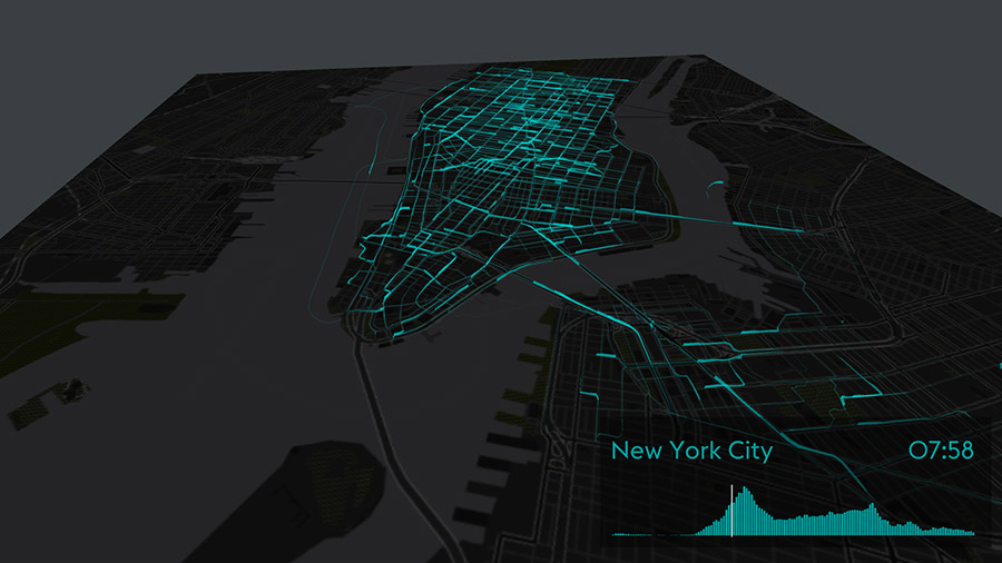
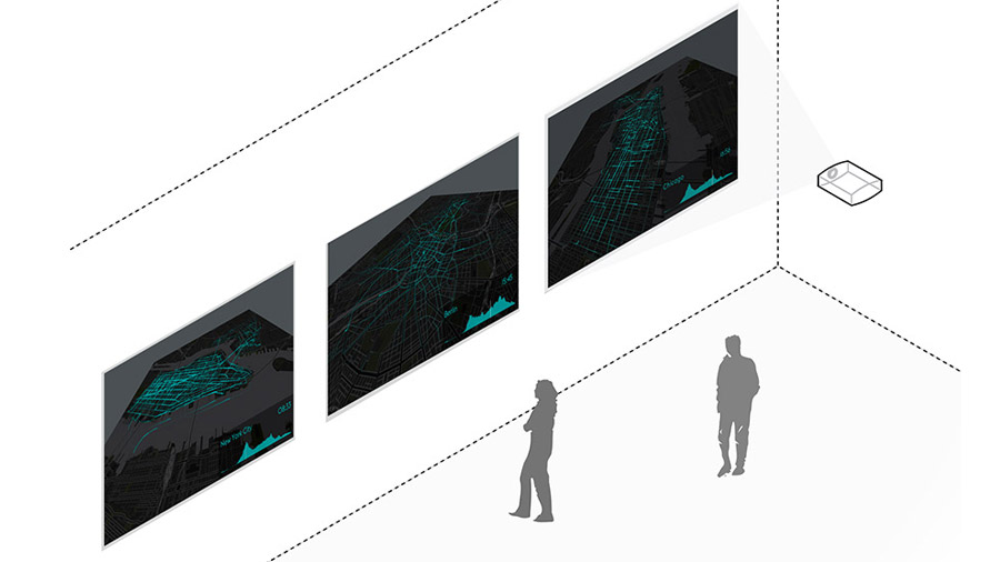
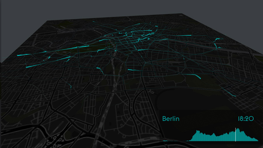
Three high-resolution screens show the space of flows of New York City, Berlin, and London through visualizing bike sharing systems of these world cities. By showing the flow of multiple cities side by side, we can compare their extent and dynamics. Tracing urban movements accentuates different urban structures, and contrasts grid-plan cities like New York with historically grown cities such as Berlin. It also enables us to observe and dwell on similarities and differences in various bike-sharing systems. With our visualizations we want to understand the pulse of urban mobility, and create portraits of a city defined by its transient dynamics.
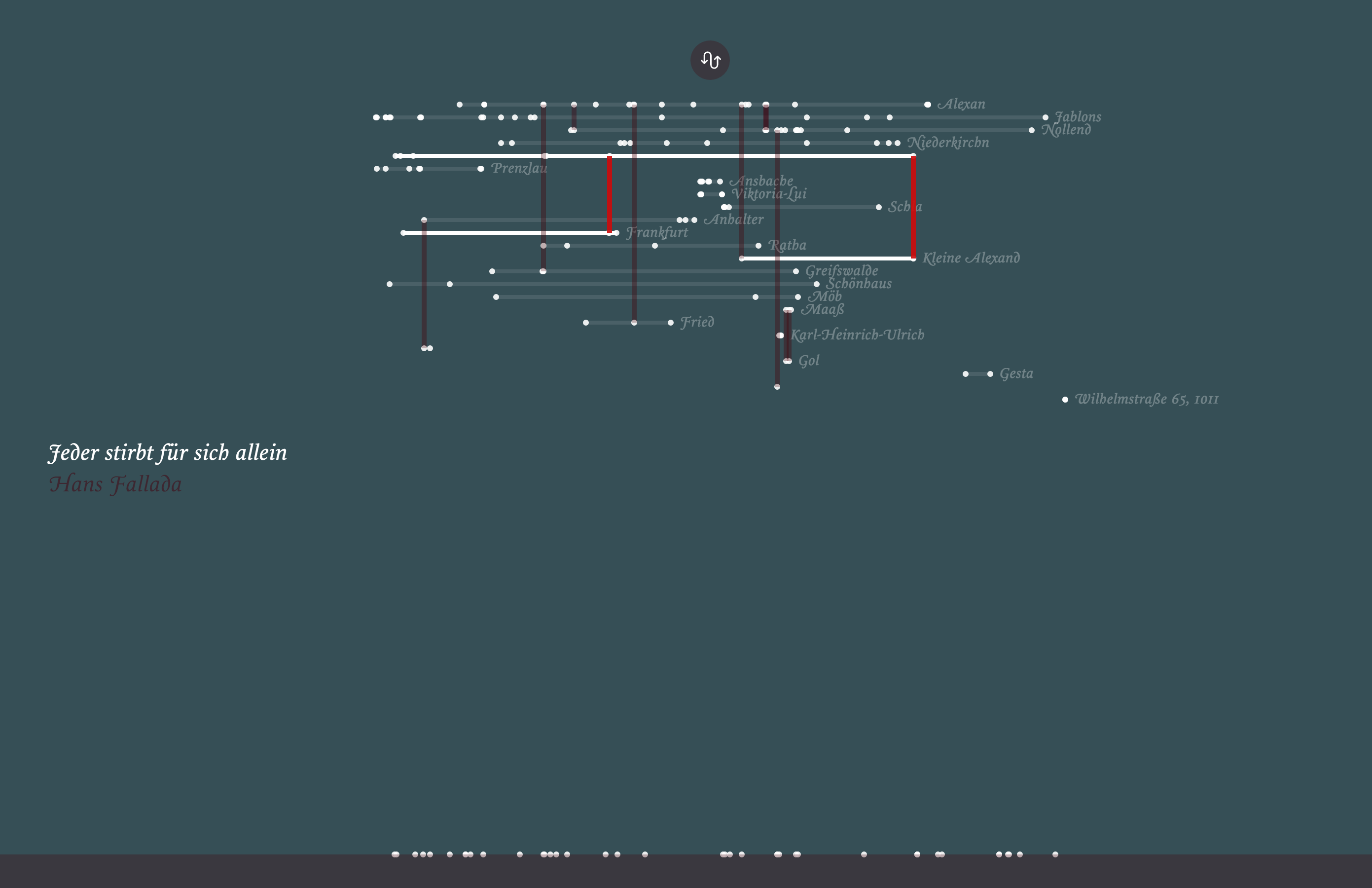
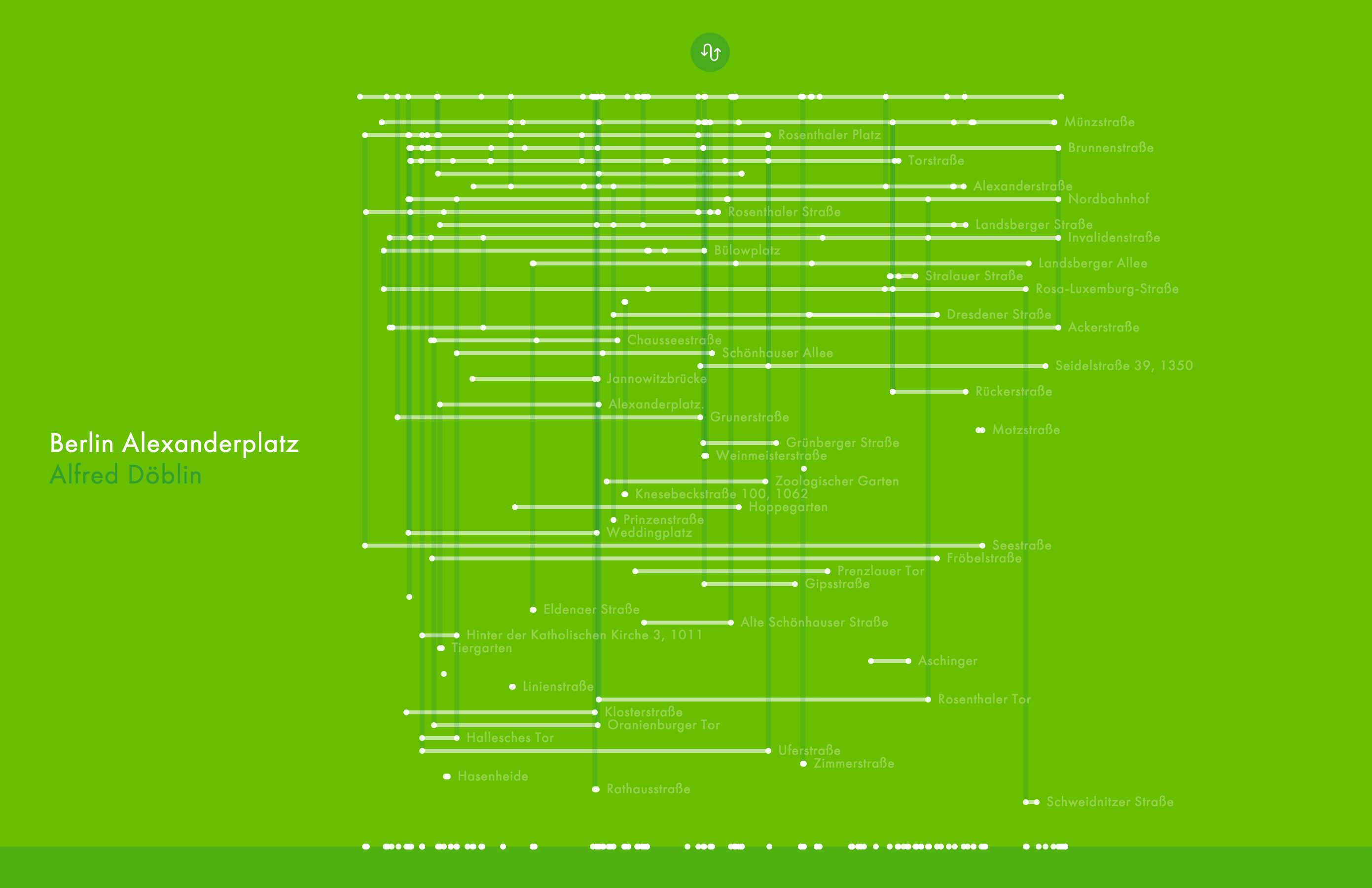
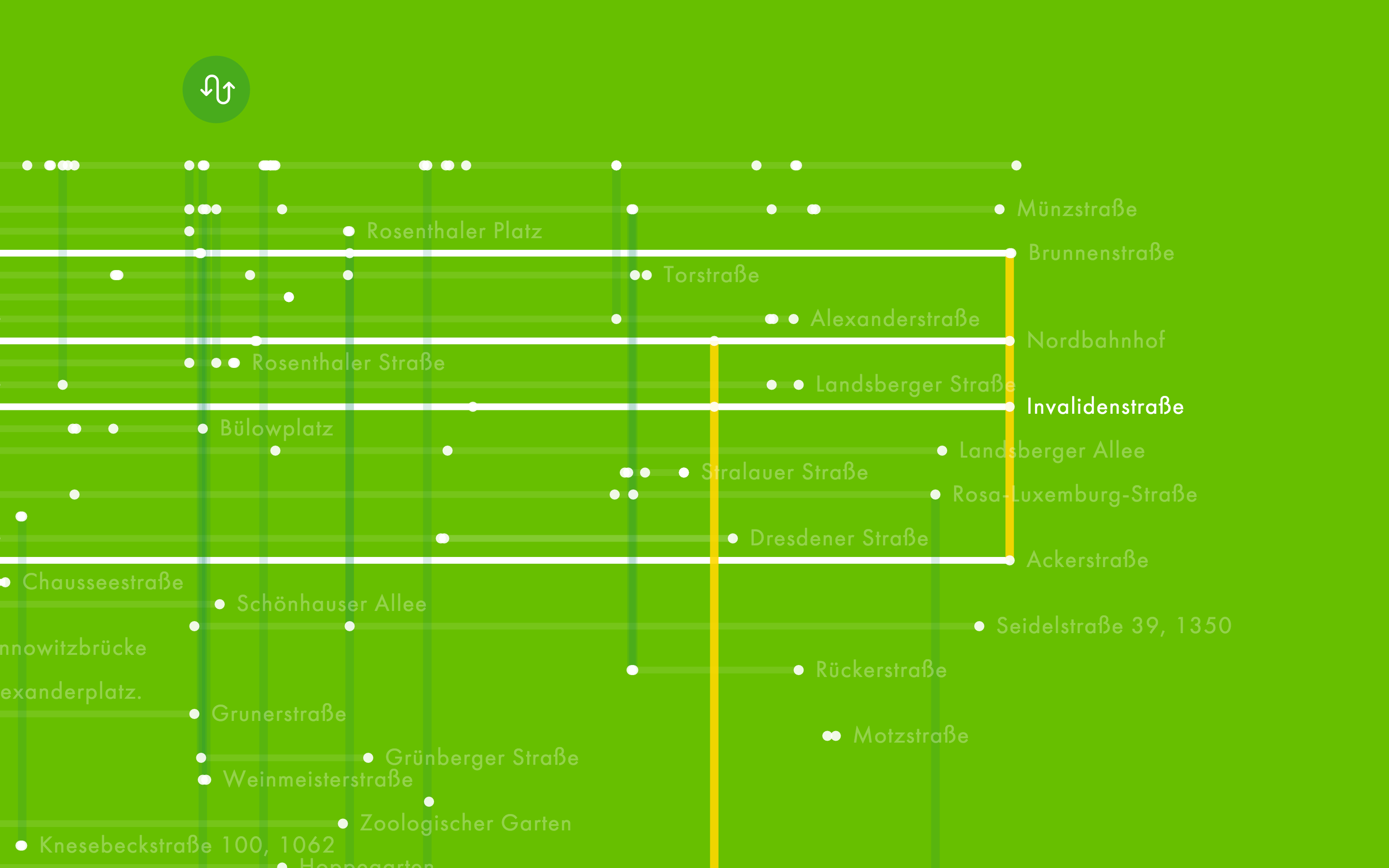
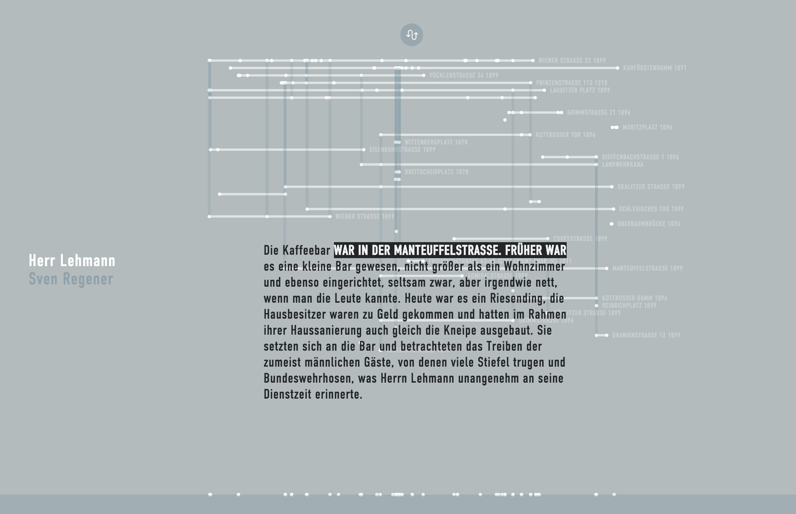
How do impressions of a city change depending on author, time and context? The project Novel City Maps visualizes the description of spatiality in Berlin novels and its relation to the story in new kinds of poetic maps that have their origin in the complex tissue of the underlying stories rather than the infrastructure of the city.
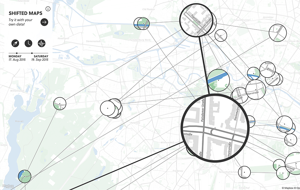
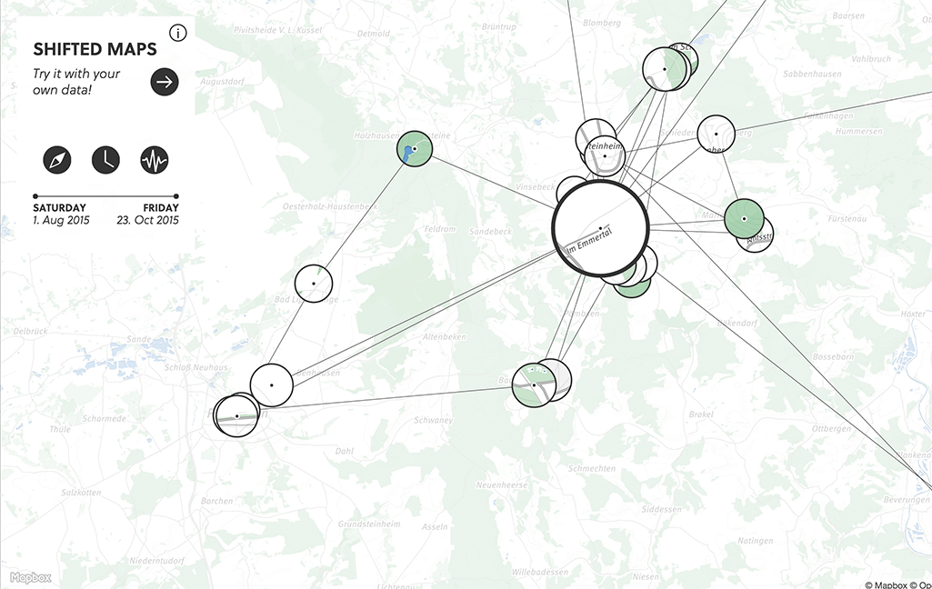

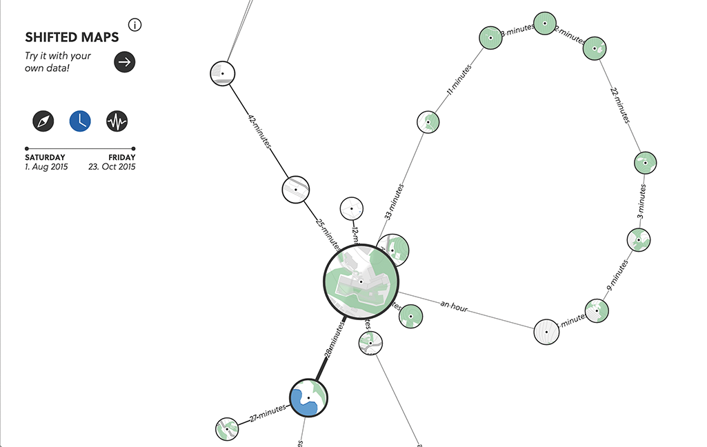
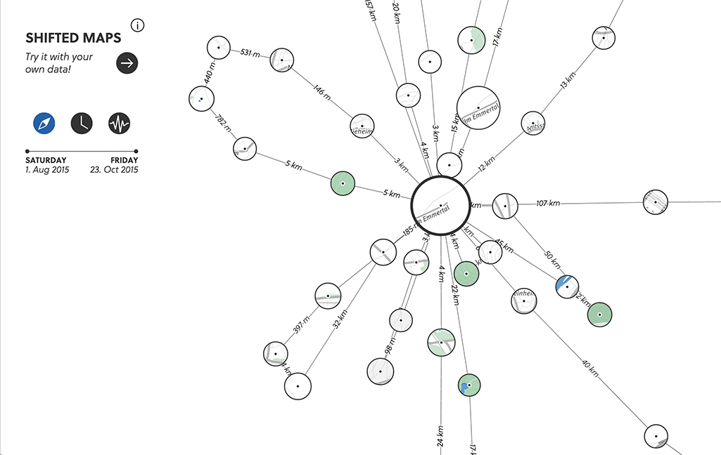
Are there networks in maps? Shifted Maps visualizes personal movement data as a network of map extracts showing visited places. The geographic map dissolves and creates a flexible network layout, which reveals unique movement structures based on geographic positions, travel time or travel frequency.

Music is more accessible than it has ever been. With modern technology and services we can listen to almost any song we want at anytime and anywhere. This new found level of access has reduced the perceived value of music from an enjoyable artistic piece to a mere consumable. What if certain music could only be heard in certain places? Berta emphasizes the exclusivity of select music by limiting the playback to a certain area or place defined by the musician. Berta is a compass for music – showing the distance and direction to the closest song location. As the listener approaches the destination, Berta begins to play the musicians’ story about the song and why they chose the location to place their song. Once the story has ended, Berta will play the song on her internal speakers. This process of navigation, storytelling, and listening, actively engages the listener in a more meaningful and memorable manner. Berta emphasizes the uniqueness and the experience of a musical piece. Berta is not an app but rather a physical object with heart and soul.
You +1 can meet Berta. To ask Berta out on a date, send your application to ahoi[at]bertaberlin.de.
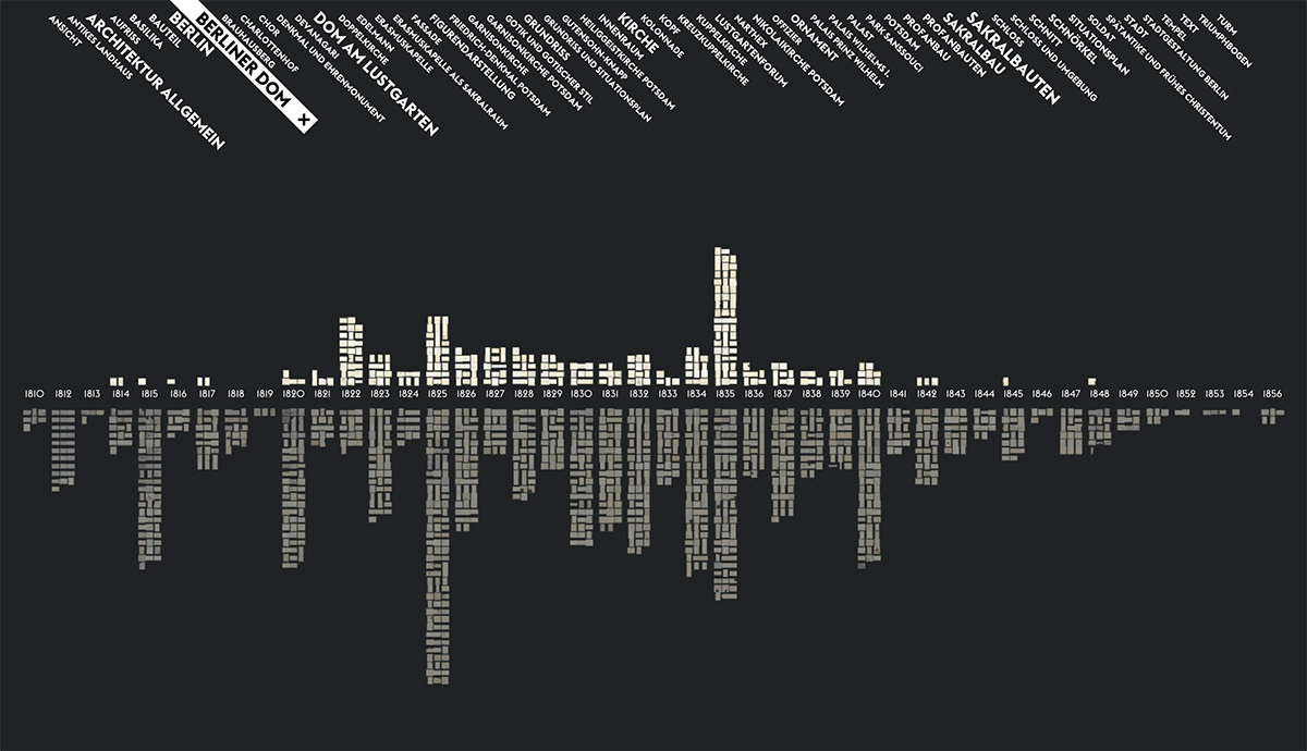
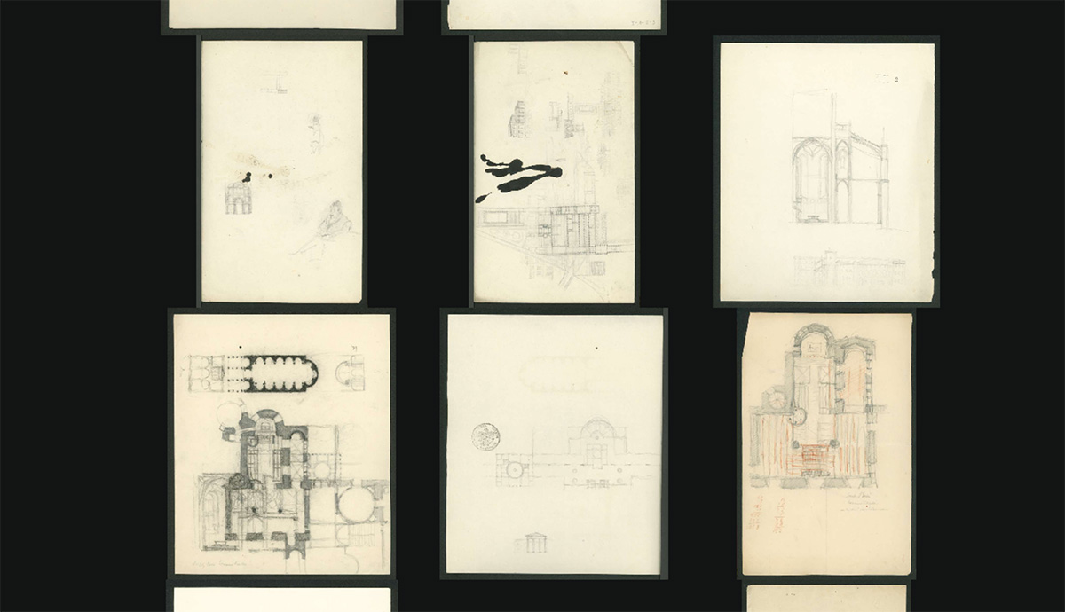
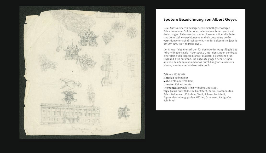
Friedrich Wilhelm IV of Prussia (1795-1861) left a collection of drawings behind. Among these are architectural and urban planning visions for Berlin and Potsdam. The drawings of the king are part of the collection of prints and drawings of the Prussian Palaces and Gardens Foundation Berlin-Brandenburg. They bear witness to historical events such as wars and revolutions, literary influences or personal obsessions with the devil. Many drawings show the planning view of the king, who designed architectural and urban planning visions for the future city, 200 years ago. The visualization shows thematic and historical connections within the drawings and makes them available for exploration in high resolution.
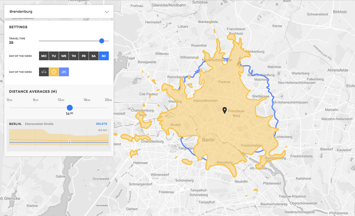
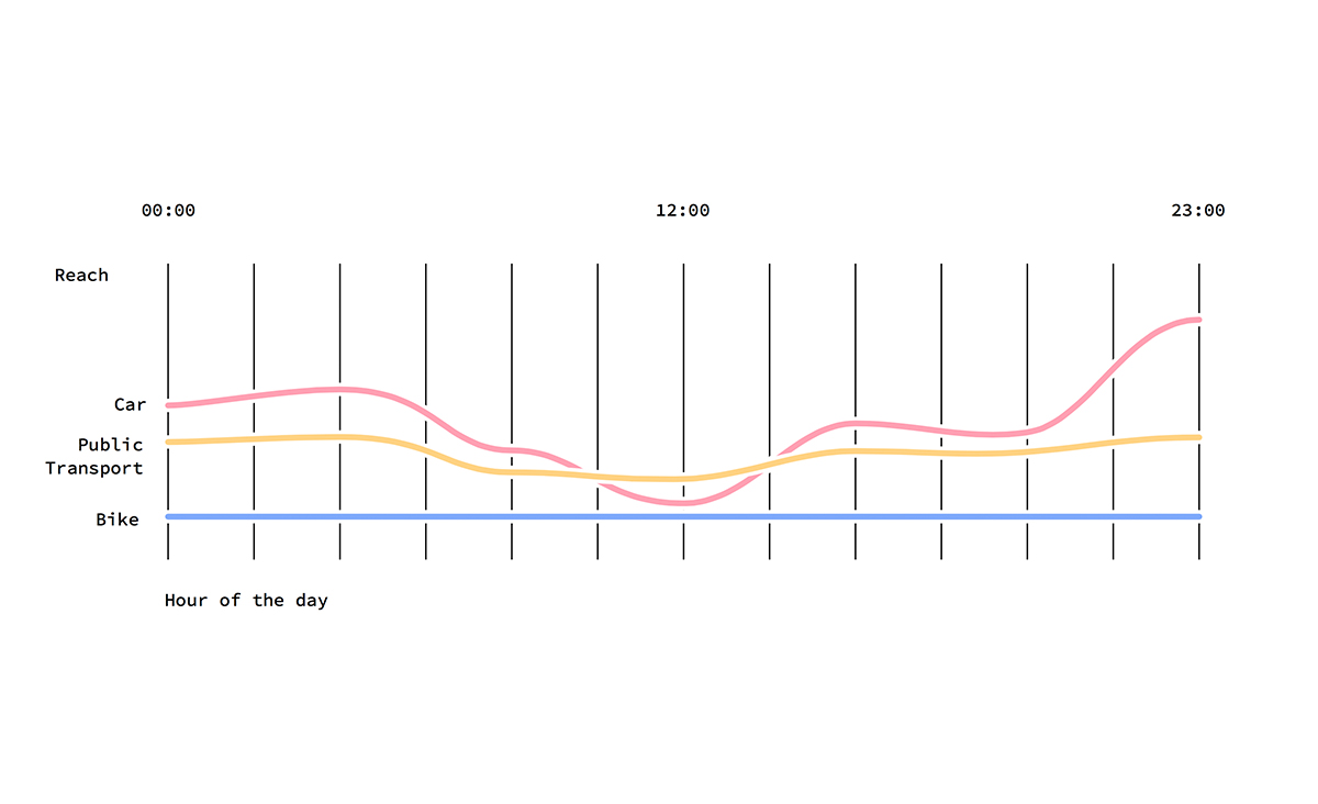
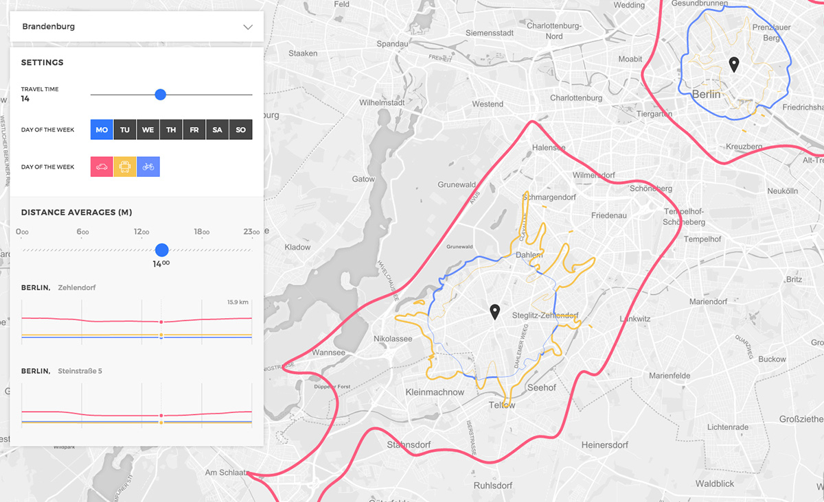
Isoscope Two maps the time-varying quality of mobility. A web-based tool displays reachable areas of different transport modes in a unified visualization with the help of layered isochrone maps. The visualization allows comparing how travel patterns change over time, and how spatio-temporal variations affect urban mobility. In contrast to conventional isochrone maps which display distances in regular intervals, this project tries out new ways of displaying multiple categories of overlapping isolines at the same time.
This work is based on Isoscope 1.0 by Flavio Gortana, Sebastian Kaim, and Martin von Lupin under supervision by Till Nagel.
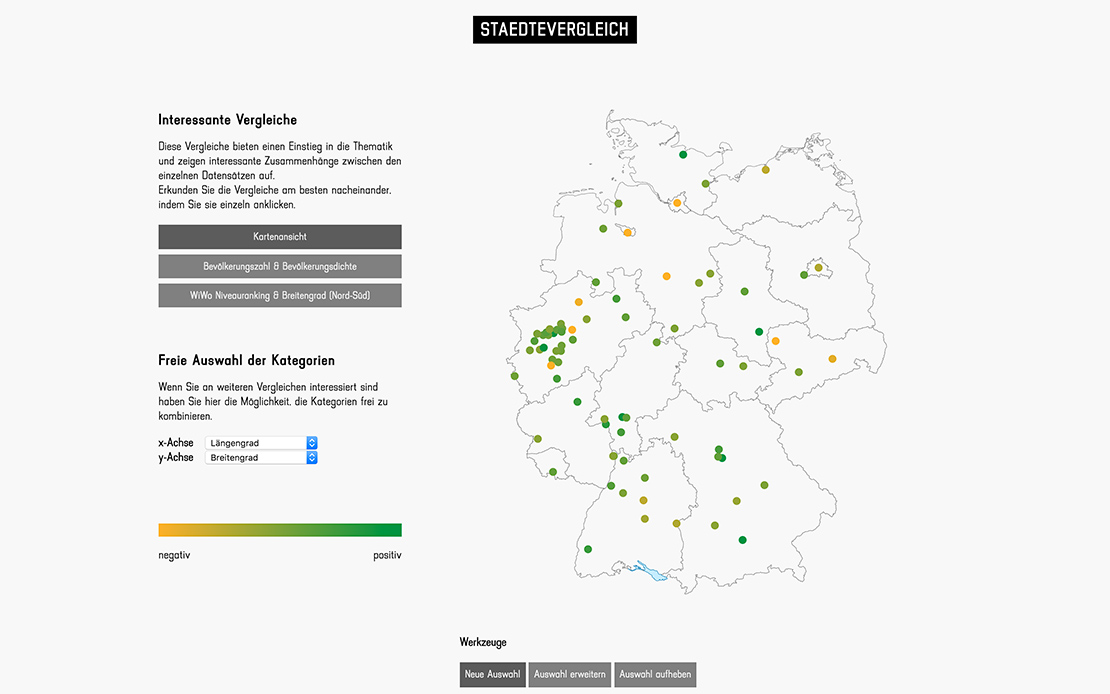
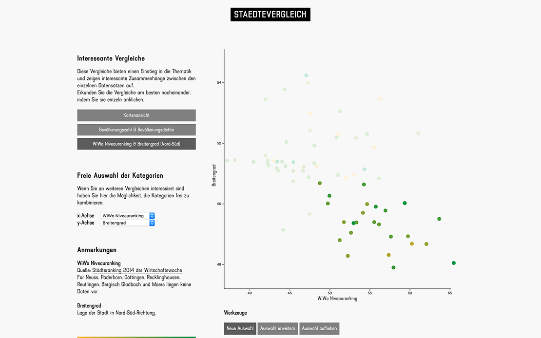
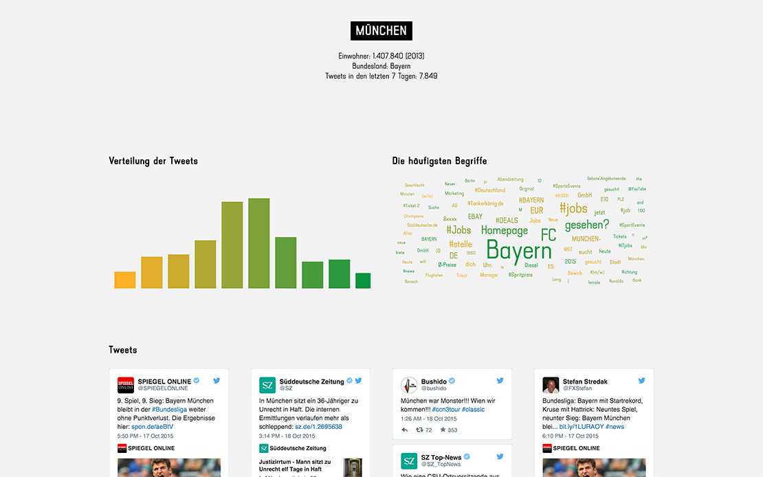
The Visualization analyzes the mood of the 76 biggest german cities based on the tweets written there and about them. It shows which emotions and topics occur in a city. The social media data is complemented by geographic and socio-economic data. The tweets can be discovered by interacting with the visualization. The visualization helps us to see and understand the patterns of urban social media communication. It is possible to discover similarities and contrasts between cities and to see the traces of communication left by humans.
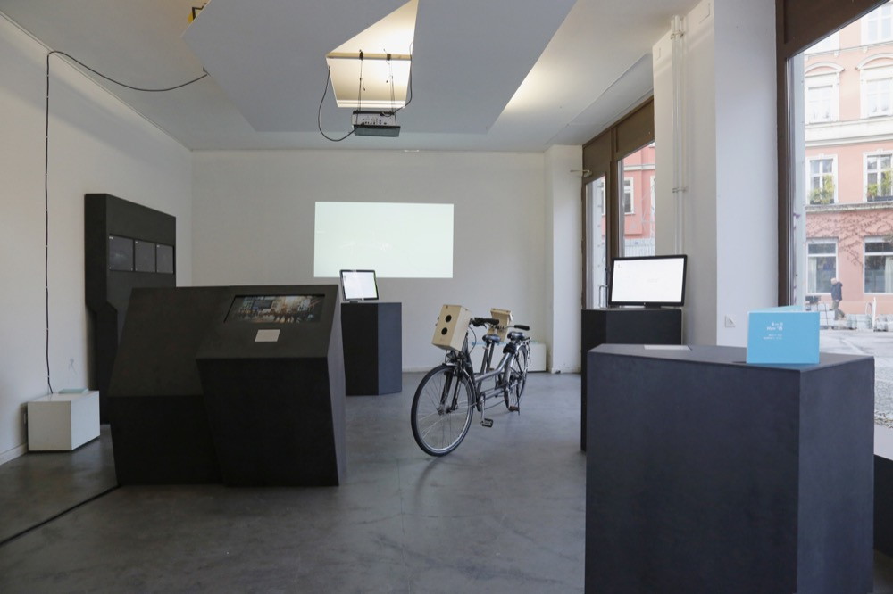
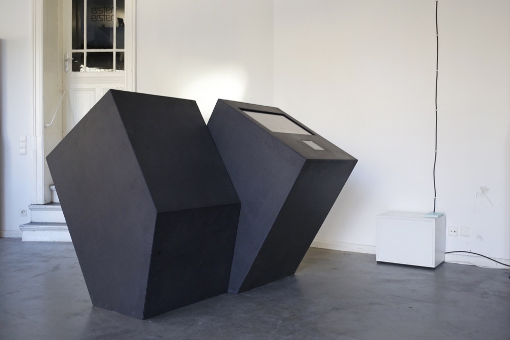
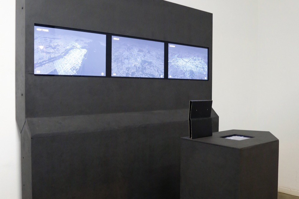
The exhibition concept of Streams and Traces consists of four different types of furniture modules: Two big cabinets, two big terminals, four steles and a portable tablet holder. We were inspired both by the ground-plan of the room and the works displayed. For the different pieces of furniture we rotated, extruded and multiplied the polygonal shape. Thus the collection of pieces show a rich variation of shapes while at the same time it succeeds in forming a visual entity. The material used was black colored medium density fibreboard. The surface was deliberately left unsealed preserving the visitors individual traces on the surfaces of the pieces. The pieces were constructed by Samira, Andrea and Christian at the Potsdam University of Applied Sciences under helpful guidance from Anne Boenisch.
